The Annapurna Base Camp (ABC) Trek Map is an essential tool for anyone planning to undertake this iconic journey in 2025. This map not only outlines the trail but also provides valuable insights into elevations, distances, landmarks, and accommodations along the way. In this blog, we’ll explore how the Annapurna Base Camp trekking map can enhance your trekking experience while detailing the itinerary for the ABC Trek 2025. Whether you're a seasoned trekker or a beginner , understanding the map will help you navigate the trail with confidence.
Why the Annapurna Base Camp Trekking Map Matters
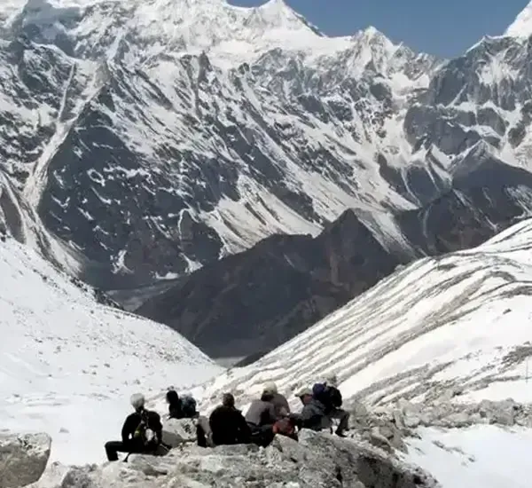
The Annapurna Base Camp Trek traverses diverse terrains, from lush forests and terraced fields to alpine meadows and glacial basins. Having a reliable map ensures that you:
- Stay on track: Avoid detours and unnecessary risks.
- Plan effectively: Visualize distances and elevation gains.
- Locate accommodations: Identify tea houses and resting points.
- Understand landmarks: Gain insights into key viewpoints and cultural sites.
Key Features of the Annapurna Base Camp Trek Map
- Detailed Elevation Profiles: The map highlights the steep ascents to Poonhill and Annapurna Base Camp, allowing you to pace yourself.
- Trail Distances: Each segment of the trek is marked with distances in kilometers and miles.
- Accommodation Points: Locations of tea houses in Ghorepani, Tadapani, Chhomrong, and beyond.
- Major Landmarks: Key highlights like Poonhill , Machhapuchhre Base Camp (MBC) , and Jhinu Danda hot springs.
- Weather Zones: Understand the climate variations across different altitudes.
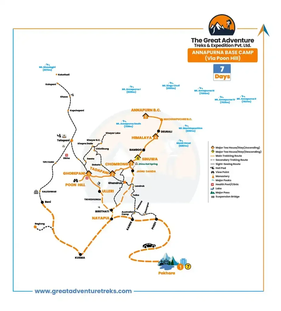 Annapurna Base Camp Trek 7 days route map 2025
Annapurna Base Camp Trek 7 days route map 2025
Annapurna Base Camp Trek Itinerary 2025
Day 01: Drive from Pokhara to Ulleri (2050m /6724 ft), Trek to Ghorepani (2880 m/ 9446 ft)
- Distance: 11 km / 6.02 mi
- Duration: 6-7 hours
- The trek begins with a scenic drive from Pokhara to Ulleri, followed by a challenging uphill hike through rhododendron forests. Ghorepani offers stunning views of the Annapurna and Dhaulagiri ranges.
Day 02: Hike to Poonhill (3210 m / 10529 ft) and Trek to Tadapani (2630 m / 8626 ft)
- Distance: 11.5 km / 7.1 mi
- Duration: 6-7 hours
- An early morning hike to Poonhill rewards trekkers with panoramic sunrise views. The trail then descends and ascends through forested ridges to reach Tadapani.
Day 03: Trek to Chhomrong (2170 m/ 7118 ft)
- Distance: 10 km / 6.2 mi
- Duration: 5-6 hours
- The trail winds through terraced fields and small villages, offering a glimpse of Gurung culture. Chhomrong serves as the gateway to the Annapurna Sanctuary.
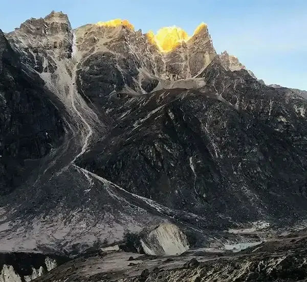
Day 04: Trek to Himalaya (2920 m / 9578 ft)
- Distance: 12 km / 7.4 mi
- Duration: 6-7 hours
- Passing through bamboo forests and serene valleys, the trek becomes more secluded. Himalaya is a quiet resting point surrounded by towering peaks.
Day 05: Trek to Annapurna Base Camp (4,130 m / 13,546 ft) via Machhapuchhre Base Camp (3700 m / 12,136 ft)
- Distance: 12.5 km / 7.7 mi
- Duration: 5-6 hours
- This segment is the highlight of the trek. The trail ascends through moraines to reach MBC, and finally, the awe-inspiring Annapurna Base Camp , encircled by majestic peaks.
Day 06: Trek to Sinuwa (2310 m / 7577 ft)
- Distance: 14 km / 8.6 mi
- Duration: 7-8 hours
- The descent begins, retracing steps through bamboo groves and forests to reach Sinuwa.
Day 07: Trek to Jhinu Danda (1780 m / 5838 ft), Drive to Pokhara
- Distance: 8.5 km / 5.2 mi
- Duration: 3-4 hours trek, 2-3 hours drive
- The final leg leads to Jhinu Danda , where trekkers can enjoy the natural hot springs. A drive back to Pokhara concludes the journey.
Annapurna Base Camp Trek Altitude Chart: