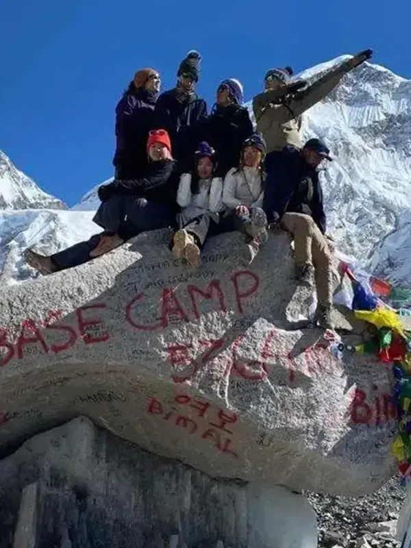
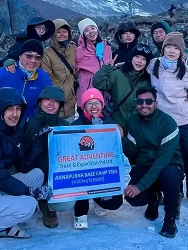
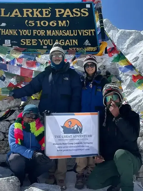
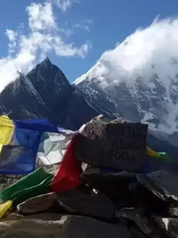
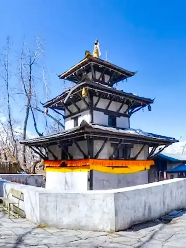
10 Highest Mountain Passes In Nepal

10 Highest Mountain Passes In Nepal

Nepal is typically a trekker’s paradise located in the southern lap of the Himalayas. The country boasts a striking diverse geography, which includes at least 866 famous mountains. The most popular among all the peaks here is Mt Everest (8,848m)- the tallest mountain in the world. Similarly, eight out of the ten highest peaks lie in Nepal.

The same mountain ranges consist of high passes that act as formidable geographic landmarks and impede transportation. These mountain peaks are the gaps or the breaks between the mountains, facilitating viable routes through the rugged terrain.

Challenging, beautiful, and intimidating are some words that describe these high passes in Nepal. Trekkers who have crossed these high passes know how difficult yet captivating these mountain passes are.

Located between the two mountains, this high pass makes a route for magnetic mountain villages in the Himalayas. It rises high from the ground and conceals the surrounding areas from the outside world. Therefore when you visit Nepal for any trekking journey, do not miss to check out the top 10 mountain passes in Nepal.

1. Thorong La Pass (Annapurna Region)

1. Thorong La Pass (Annapurna Region)

Region: Annapurna Region

Starting Point: Bhulbhule

Altitude: 5,416m

Nearest Landmarks: Yak Kharka and Muktinath

Best Time: Spring and Autumn Season

Permits: TIMS and ACCAP Permits

Treks Related with pass– Annapurna Circuit Trek, Thorong La Pass Trek

Throng la pass in the Annapurna region is the highest point of the famous trek- Annapurna Circuit trek. Located at an impressive high elevation of 5,416 meters (17,769 feet), crossing the pass with the Annapurna Circuit trek presents both a challenging and exhilarating experience for trekkers.

Annapurna Circuit is the famous trekking route of Nepal. Thus this pass is an important section of the trek. Simply say, the trek is considered incomplete if trekkers do not cross this pass.

Annapurna circuit trek involves crossing the Tholong la Pass, typically taking 14 to 21 days to complete. Similarly, the trek covers 160 to 230 kilometers (100 to 145 miles), depending on route choices and side trips.

This pass is formed by two mountains: Khatung Kang (6,484m) and Yaskawa Kang (6,482m). Throng la pass connects two famous landmarks of the region, i.e., Muktinath temple ( revered by both Hindus and Buddhists) to the west and Manang village to the east. The pass also divides two different river valleys of the region, Kali Gandaki and Marsayangdi.

The pass is stunning in itself as it offers the trekkers to embrace the immersive views of the peaks like Dhaulagiri, Gangapurna, Annapurna (I-IV), Langtang Lirung, and many more. However, the risks related to the trek, such as AMS, are evident because of its location. Therefore, trekkers must be well-acclimatized for a two or more days at Thorong Phedi or Manang Village.

Highlights-

  • Embark on a Classic trek on the ancient trade routes.
  • Ascending alongside the Marshyangdi Valley
  • Explore and rest at the beautiful Manag village
  • Crossing the Thorung- La ( 5416m)
  • Visit The Pilgrimage town of Muktinath

How to Reach Thorong La Pass

The best way to reach and cross the Thorong La Pass of the Annapurna region is to embark on a classic Annapurna Circuit Trek or Thorong la Pass trek. In fact, the pass is the main highlight of the 15-day Annapurna tourist trek and the highest point you will reach during the trek.

You are ready to cross the pass after almost one day of driving to Bhulbhue and 9 days of trekking via landmarks like Chyamje, Bagarchhap, Chame, and Pisang. Crossing the pass with an Annapurna quick trek is moderately difficult and can be done by trekkers who have completed at least one trek in the Nepalese Himalayas. The first section involves trekking to Manang, also called the acclimatization village of the trek. The second part of the trek takes you from Manang to Ledar to a high camp via Tilicho Lake and high camp. And the final part of the trek takes to the Muktinath temple via the Thorong La pass.

2. Cho La Pass (Everest Region)

Cho La Pass (Everest Region)

Region: Everest Region

Starting Point: Lukla

Altitude: 5,420m

Nearest Landmarks: Gokyo Valley, Thagnak village

Best Time: Spring and Autumn Season

Permits: TIMS and Sagarmatha National Park permit

Treks Related with pass- Gokyo Chola Pass, Everest base camp trek via Cho la pass, and Gokyo, Everest three passes trek

Cho la pass at 5420 meters / 17780 feet is one of the thrilling high passes. It lies in the Everest region and connects several noteworthy attractions. Similarly, the trail leading to the Chola Pass connects the famous Everest base Camp to the east and Gokyo Lakes to the west.

Chola Pass is part of the Everest Region Three High Pass. The pass joins the Dzongla Village on the eastern side and Thagnak Village on th western side. The pass is between the two famous peaks of the region Cholatse (6,440m) and Lobuche (6,119m) and privies stunning views of mountains like Cho Oyu, Mt. Everest, and many more.

Crossing Chola la pass is one of the main highlights as it boosts the excitement of the Everest base camp trek, Gokyo Lakes treks, and Gokyo Valley trek. You can also choose to hike on the trail both clockwise, etc., then Gokyo via Cho la pass, or anticlockwise, Gokyo, then EBC via Cho La Pass.

Highlights-

  • Trek across one of the Everest region’s high passes at (5420m)
  • Explore the surrounding admires like Gokyo Ri, Gokyo lakes, and Gokyo Village
  • Visit to Everest base camp and Kala Patthar
  • Witness icefall and glaciers

How to Reach Cho La Pass

Cho la pass is a moderate trek and can be completed by trekkers with moderate fitness levels. The Cho La Pass route connects the EBC trek and the Gokyo Lake route. Therefore the best way to reach this pass is by doing treks like EBC to Gokyo via Cho la pass trek, Gokyo to via Cho la pass trek, and Everest three passes trek.

3. Renjo La Pass (Everest Region)

Renjo La Pass (Everest Region)

Region: Everest Region

Starting Point: Lukla

Altitude: 5,360m

Nearest Landmarks: Gokyo and Lumde

Best Time: Spring and Autumn Season

Permits: TIMS and Sagarmatha National Park permit

Treks Related with pass– Everest Three passes Trek or Gokyo Lake Treks

If it’s the panorama of Mt Everest you want to look at during your trek, then look no further than Renjo La Pass. The pass is located above Dudh Pokhari’s western shore and is perhaps the easiest passing other three passes of the Everest region. The pass at 5,360m in Sagarmatha national park is a low-altitude pass with almost no glaciers and fewer snow piles. Similarly, it connects the famous landmarks of the region, i.e., Lumde Village with Gokyo Valley.

And during your hike to the pass, you can see the views of Mount Everest and other prominent peaks like Lhotse, Rolwaling Himal, Makalu, Cho Oyu, etc. These panoramas are so beautiful that they can even outstrip the views that can be seen from Kala Patthar.

Trekkers wanting to cross the Renjo La Pass mostly prefer to do the Three Passes trek or Gokyo and Renjo La Pass trek. Trek to Renjo La Pass is much easier than the other two passes, i.e., Cho La Pass and Kongma La Pass. Still, trekkers should not underestimate the pass and be well prepared.

Highlights-

  • Pass the adventure pass at 5360m in the Khumbu region
  • One of the famous mountain passes of the Everest region
  • Visit Gokyo ri and Gokyo valley
  • stunning panoramas of the Everest Himalayas
  • Visit landmarks such as Namche Bazaar, Khumjung, and Thame

How to Reach Renjo La Pass

Renjo La Pass trek is mainly done with the Everest Three Passes trek. The trek starts with a scenic flight to Lukla from Kathmandu. Afterward, it’s a trek through the various sherpa villages like Phakding and Lumde before finally crossing this high pass.

4. Kongma La Pass (Everest Region)

Kongma La Pass (Everest Region)

Region: Everest Region

Starting Point: Lukla

Altitude: 5,550m

Nearest Landmarks: Chukhung and Lobuche

Best Time: Spring and Autumn Season

Permits: TIMS and Sagarmatha National Park permit

Treks Related with pass– Everest Three passes Trek

Kongma la Pass, at 5,550 m/ 18,209 ft in the Everest region, is the most skipped mountain pass among the three passes in the region. Most trekkers prefer not to cross this pass because of its complex nature. The pass lies opposite the Lobuche Peak and just above the Khumbu glacier. Similarly, its route is completely rocky, which demands extra attention and preparedness for the trek who wants to cross it.

Despite its difficulty, every trekker should consider trekking to this high pass as it offers a thrilling experience of climbing the mountain pass and outlook of the mountain ranges like Everts, Cho Oyu, etc.

The pass route is separate that heads towards the Everest base camp. The trail of Kongma La Pass follows the standard EBC trek route until Dingboche. From here, the route follows Chukkung and then passes via the rugged terrains.

Highlights

  • Close-up views of the majestic peaks of the Everest region like Mt Everest, Lhotse Nuptse, etc.
  • Visit Namche Bazaar ( wonderful sherpa village)
  • Cultural exploration of the Everest region
  • Breathtaking views of glacial lakes and the Himalayas

How to Reach Kongma La Pass

Kongma la Pass is part of the Everest Three Pass trek. To reach the pass, trekkers must first take a flight from Kathmandu to Lukla and follow the EBC route upto Dingboche. The second section of the trek takes you from Dingboche, Chukhung, Chukhung Ri, and to Lobuche via Kongma La Pass.

Most people prefer to embark on the Everest base camp trek. Others who want to spend more time in the region head out for short treks up and over the Kongma La Pass. If you want to trek to Kongma La Pass, you can just complete the Kong La Ma Pass trek or all three passes. Trek.

5. Larkya La pass (Manaslu Region)

Larkya La pass (Manaslu Region)

Region: Manaslu Region

Starting Point: Soti Khola

Altitude: 5,106m

Nearest Landmarks: Bimtang and Dharmasala

Best Time: Spring and Autumn Season

Permits: Manaslu Restricted Area Permit, Manaslu Conservation Area Project, Annapurna Conservation Area Project

Treks Related with pass- Manaslu Circuit Trek, Larkya La pass Trek

Laykya la Pass, at 5,106m/16748 in the Manaslu region, is one of Nepal’s longest and most dramatic mountain passes. Every trekker who has completed their Manaslu circuit trek knows how beautiful yet challenging this pass is. The pass is the high point of the famous trek, i.e., the Manaslu trek.

Hundreds of trekkers from worldwide flock to the region just to complete the Mansu circuit trek and cross the Larkya la pass. Once mentioned as “one of the most dramatic pass crossings in the Himalayas.” the lonely planet pass provides incredible views of the mountain to admire, like Himlung Himal, Annapurna II, Cheo Himal, and many more.

The journey to the pass with the Manaslu Circuit trek is undoubtedly a challenging advantage for trekkers. Regarding difficulty, the trek to the pass is often compared with Everest’s Cho La Pass.

Highlights

  • Beautiful views of the mountains like Ngadi Chuli, Manaslu, Himchuli, Ganesh Himal, and many other peaks.
  • Beautify varied landscape
  • Encounter different flora and fauna during the trek
  • Tibetan influenced religion pratices, cultuerand tradistions.

How to Reach Larkya La Pass

Following the itinerary of a Manaslu trek is a great way to reach the Larkya La pass. With this trek, trekkers will follow the standard itinerary that takes them through the off-the-beaten path and remote areas of the region. The trek’s highest point is Larkya La Pass, which trekkers can reach after crossing Jagat, Dyang Namrung, Samagaon, and Dharamsala.

6. Lauribinayak La Pass (Langtang Region)

Lauribinayak La Pass (Langtang Region)

Region: Langtang Region

Starting Point: Ghopte

Altitude: 4,460m

Nearest Landmarks: Gosainkunda and Kutumsang

Best Time: Spring and Autumn Season

Permits: TIMS, National Park permits, or Conservation permits

Treks Related with pass– Gosaikunda Lake Trek, Or Lauribinayak La Pass Trekking

Lauribinayak La Pass, at 4,460m, is a popular mountain pass in the Langtang region. The pass is located just above the sacred Gosaikunda Lake. In fact, the pass is mainly visited by trekkers and pilgrims just to admire the pass’s grandeur and the Gosiankunda Lake.

Lauribinayak La Pass, or Gosiankunda lake trek, is a remote trek that takes trekkers to the off-the-beaten trail, which is less crowded and more fascinating.

Lauribinayak La Pass is an easy-to-moderate difficult trek that requires trekkers with moderate fitness levels to cross it. The trek takes you via the Langtang National Park, a protected area that shelters rare and endangered animals like musk deer, Himalayan wild goats, snow leopards, and many more.

Highlights

  • Trek through remote and rural settlements
  • Experience the authentic lifestyle of the locals
  • Visit Gosainkunda Lake
  • Cross Lauribina Pass
  • Visit different ancient and historical monasteries
  • Encounter prayer flags and other Buddhist practices and cultures

How to Reach Lauribinayak La Pass

Trekkers reach Lauribinayak La Pass via Nepal’s popular Gosaikunda Lake trekking trail. The trek’s trailhead is Syabrubesi, which trekkers can reach by bus or private jeep. It’s a 7-8 hours ride from Kathmandu to Syabrubesi.

Interested trekkers travel by local bus that gets off from Gongabu Bus Park or Macchha Pokhari at around 6.30 am- 8 am. From Syabrubesi, the trekking section starts, taking you to Sing Gompa and Gosaikunda Lake and finally to the pass after a 6/7 hour trek from the Gosainkunda Lake.

7. Selele Pass (Kanchenjunga Region)

Selele Pass (Kanchenjunga Region)

Region: Kanchenjunga Region

Starting Point: Selele Camp

Altitude: 4,480m

Nearest Destination – Ghunsa and Cheram

Best Time: Spring and Autumn Season

Permits: Restricted Area Permit, Kanchenjunga Conservation Area Project

Treks Related with pass- Kanchenjunga Base Camp Trek via Sele La Pass, Sele La Pass Trek

Selele Pass, at 4,480m, is another remote and less visited pass in Nepal’s Kanchenjunga region. It lies at the foot of Mt. Kanchenjunga (8586m), the third-highest peak, and connects villages like Ghunsa and Cheram.

Most trekkers first trek to Kanchenjunga Base Camp before finally crossing this pass. The trek to the pass is difficult; only a few trekkers cross this pass. The route of the treks takes you via the juniper forest, dense rhododendron, and moss. Similarly, while crossing this pass, trekkers can witness the panorama of the peaks like Jannu Peak, Kanchenjunga, Chang Himal, and many more.

Highlights

  • View of Mount Kanchenjunga (3rd highest peak)
  • experience both Tibetan and traditional Nepali and Tibetan culture
  • Trek through wild and unspoiled nature
  • Crossing the several Glacier
  • Cross High pass, i.e., Sele La pass.
  • Trek through the Kanchenjunga Conservation Area

How to Reach Sele le Pass

Trek to Selela pass is mainly done along with the Kanchenjunga base camp trek. To reach the pass, trekkers first reach the Kanchenjunga base camps.

The journey starts with a flight to Biratnagar and Suketar. Afterward, the route passes via villages like Chirwa, Amjilassa, Gyabla, Sakathum, Khambachen Pangpema, and Ghunsa. The final section of the trek starts Ghunsa to Sele La High Camp via Sele La Pass.

8. Numa La Pass (Dolpo Region)

Numa La Pass (Dolpo Region)

Region: Dolpo Region

Starting Point: Numa La Base Camp

Altitude: 5,310m

Nearest Landmark– Phoksundo Lake and Ringmo

Best Time: Spring and Autumn Season

Permits: Shey Phoksundo National Park permit and Lower Dolpo restricted-area permit

Treks Related with pass– Numa La Pass and baga La Pass Trek, Lower Dolpo Circuit Trek

Numa la Pass 5,310 m/17,421 ft) is a remote pass located in the Dolpo region of Nepal. It’s one of the lesser-known passes and is visited by very few trekkers compared to other passes in Nepal.

This pass is just above the Numa La Base Camp and provides the beautiful sights of the Himalayas and surreal landscapes. The pass is reached by doing Lower Dolpo Trek.

Besides crossing the pass, this lower Dolpo trek of 18-20 days from Kathmandu also lets trekkers explore the Bon Po religion, Phoksundo Lake, and ancient Buddhist villages. Similarly, it’s a great place to admire the views of the peaks like Churen Range, Norbung Kang, and Mt. Dhaulagiri.

Highlights

  • Panoramas of the trans-Himalayan region.
  • Visit to Do-Tarap, an ancient village
  • visit to Ancient monasteries
  • Cross Numa La Pass

How to Reach Numa La Pass

The Numa La Pass trek is one of the main highlights of the lower Dolpo trek. The walk starts with a short flight from Kathmandu to Nepalgunj and then to Juphal. The trekking journey begins from Jumla taking trekkers to different landmarks like Naphukana, Chaurikot, Bheri riverside, Garpung Khola, Kagmara, Kagmara phedi, Phoksundo Lake, Numa La Phedi, and finally to Numa La Pass.

9. Amphu Lapcha Pass( Everest Region)

Amphu Lapcha Pass( Everest Region)

Region: Everest Region

Starting Point: Chukhung

Altitude: 5,845m

Nearest Landmarks– Chukhung and Amphu Lapcha Base Camp

Best Time: Spring and Autumn Season

Permits: Khumbu Pasang Lhamu Rural Entrance Permit, Sagarmatha National Park Permit (SNP) and Makalu Barun National Park Permit

Treks Related with pass– Mera Peak Climbing and Amphu Lapcha Pass, Amphu Lapcha Pass Trek

Amphu Lapcha Pass ( 5,845 meters) in Honku Valley is a glaciated pass. This pass serves as the route to the famous peak of the region. i.e., Island region.

Climbers aiming to reach the summit of the Mera peak also can cross this pass. With this in mind, the Amphu Lapcha Pass trek is mainly done along with the Mera peak climbing or Island peak climbing adventure in Nepal.

Amphu la Pass of the Everest region is challenging yet exciting to cross. It’s one of the famous passes of the region, which provides stunning views of the mountain like Everest, Cho Oyu, Lhotse, and more. Similarly, the trek to Amphu Lapcha pass is technically challenging and requires trekkers to use climbing equipment and gear to cross it.

Highlights

  • Trek to the popular peak of Nepal, ie, Mera Peak
  • Crosexplore varous hera villages
  • Eyes- Catching mountain views
  • Visit to Tyangboche monastery

How to Reach Amphu Lapcha Pass

To reach the Amphu Laptch pass, trekkers should first pass through Inkhu-Hongu Valley. The Journey starts with a short flight to Lukla and then a trek via Paiya, Panggom, Kothe, Thangnak, and Khare, then to the Amphu Lapcha Base Camp South and Amphu Lapcha pass.

10. Tashi Laptcha Pass (Rolwaling Region)

Tashi Laptcha Pass (Rolwaling Region)

Tashi Laptch Pass, at 5,755m, is a mountain pass in eastern Nepal’s remote area. The pas is a popular viewpoint which reards trekkers with the mountains views of Everest and many more.

Rolwaling Tashi Laptch pass takes trekkers to the Sagarmatha National Park and Gauri Shankar Conservation Area linking Everest region with the Rolwaling Valley. Similarly, the treks take you to many famous highlights of the region, like Namche Bazaar, Tso Rolpa Lake (4183 m), and the summit of the Tashi Lapcha Pass. The pass is located at an elevation that requires a high level of stamina and fitness for trekkers to cross it.

Region: Rolwaling Region

Starting Point: Drolumbau Glacier

Altitude: 5,115m

Nearest Landmarks– Thame and Nyiduk Kongma

Best Time: Spring and Autumn Season

Permits: Gaurishanker conservation area permits, Sagarmatha national park permit, and Pasang Lhamu Municipality permit.

Treks Related with pass– Rolwaling Tashi Lapcha Pass Trek

Highlights

  • Trek to the finest off-the-beaten-path trek
  • Visit Monasteries, high passes, and lakes
  • Encounter rich culture
  • Cross Tashi Laptcha pass

How to Reach Tashi Laptch Pass

To Tashi Lapcha Pass, trekkers must first embark on the Tashi Lapcha Pass trek with a short drive to Chechet. From Chechet, the trekking journey continues and takes you via the villages like Simi Gaun, Dhongang, Bedding, Na, Chukima, and Tolomban. The last leg of the journey takes trekkers from Tolomban to Tashi Phuk via Tashi Lapcha Pass.

Expedition In Nepal:

You may also like...

Leave a Reply

Your email address will not be published. Required fields are marked *

×